


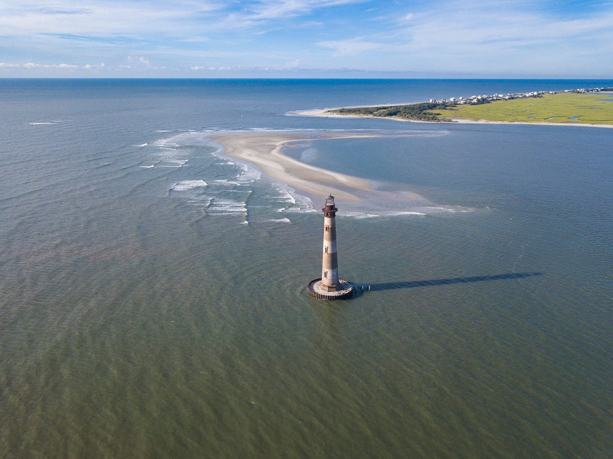
Our summer travel feature takes you to historic lighthouses along a section of the South Carolina, Georgia, and Florida coastline. In honor of America’s 250th birthday, we start at the Morris Island Lighthouse, which played a role in the American Revolutionary War. On the return trip, we’ll stop at a Revolutionary War battlefield and fort. We’ve designed this journey to span three days, but you can stretch it out if you’d like.
Compiled by the Backroad Portfolio staff
At the end of this post, our upgraded Explorer and Voyager subscribers will find Google Maps links for all three legs of the trip, plus suggestions for historic accommodations in Savannah, Georgia, and Amelia Island, Florida.
GET THERE, Day 1
Folly Beach, South Carolina > Tybee Island, Georgia > Savannah, Georgia
Backroad Route:
3 hours, 31 minutes; 142 miles
Fastest Route:
3 hours, 16 minutes; 138 miles
STARTING POINT
Day one starts at Morris Island Lighthouse—the only Southeastern lighthouse that played a significant role in the American Revolutionary War. The first leg of the trip ends after a visit to the Cockspur Island Lighthouse in Savannah.
Morris Island Lighthouse
1750 E. Ashley Avenue, Folly Beach, South Carolina
follybeach.com/lighthouse
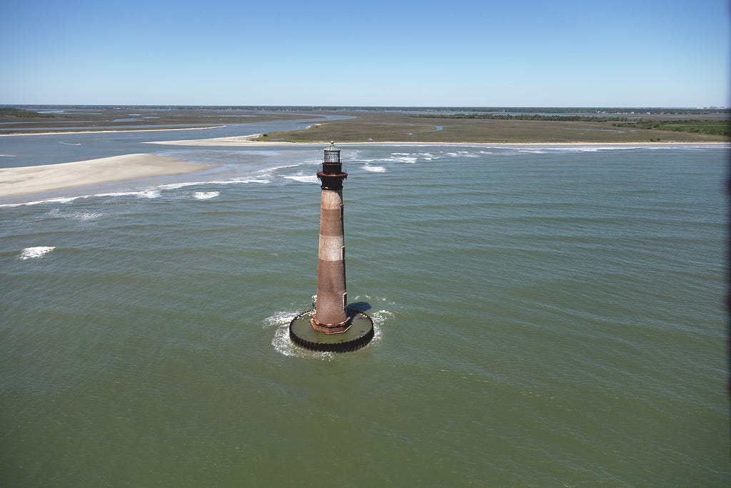
The site of Morris Island Lighthouse dates to 1673, after the founding of Charles Town, when American colonists lit fires in raised metal pans to guide ships into the harbor. By 1767, the colonists had constructed a proper lighthouse—one of approximately ten in the colonies at that time. During the American Revolutionary War, Patriots deliberately extinguished its lights to deny British ships safe navigation into Charleston Harbor, a vital port at that time.
The original 43-foot tower suffered heavy damage amid wartime actions aimed at disrupting British naval operations, though exact details vary across accounts. The lighthouse was repaired after the war, and a taller replacement standing around 102 feet was constructed in 1801. Morris Island Lighthouse later played a significant role in the Civil War. Today, the lighthouse is viewable by boat only and leans slightly northeast due to an 1886 earthquake and the effects of erosion.
Tybee Island Lighthouse
30 Meddin Drive, Tybee Island, Georgia
tybeelighthouse.org
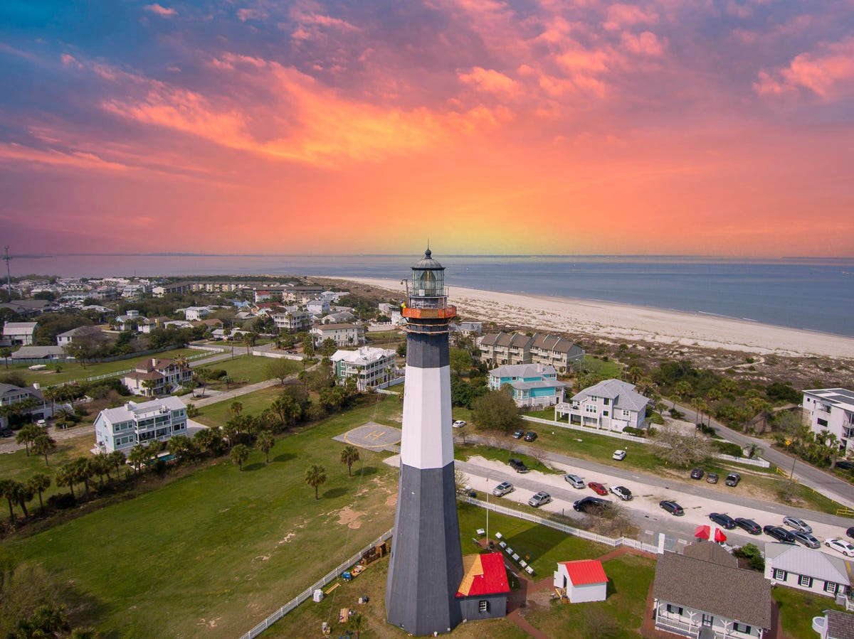
Georgia’s oldest and tallest lighthouse was ordered by Gen. James Oglethorpe in 1732 and has guided ships into the Savannah River for nearly three centuries. The first daymark was completed in 1736 under Noble Jones of Wormsloe Plantation and was rebuilt multiple times due to storms and damage, with a lighted version established later. The current 154-foot tower displays a 1916 daymark, has 178 steps, and features a first-order Fresnel Lens.
During the Revolutionary War, Tybee Island served as a staging area for French Admiral Charles-Hector D’Estaing’s ill-fated 1779 Siege of Savannah, though the lighthouse’s direct role was limited. It played a signaling function in the War of 1812 and was damaged during the Civil War when Confederates burned it to render it useless for Union soldiers. Today, the fully restored light station includes a museum in Battery Garland and offers climbs to the top for panoramic views that offer a glimpse into maritime and military history.
Cockspur Island Lighthouse
Use the Fort Pulaski National Monument address:
U.S. Highway 80, Savannah, Georgia
cockspurislandlighthouse.com
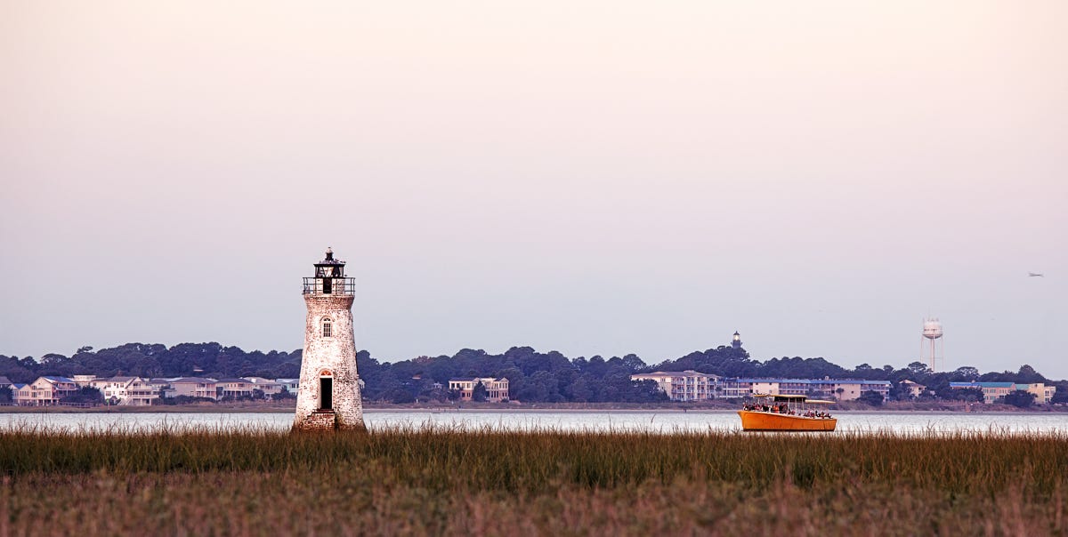
Cockspur Island Lighthouse, located on a small oyster-shell islet off the island, marks the South Channel of the Savannah River. A brick daymark suggests it was first built between 1837 and 1839. The structure was illuminated in 1849 under architect John Norris but was destroyed by a hurricane in 1854. The current 46-foot tower—made of Savannah gray bricks with a distinctive prow-shaped eastern side—was completed by 1856.
During the Civil War, the Cockspur Island Lighthouse stood in the line of fire during the 1862 bombardment of nearby Fort Pulaski but sustained only minor damage. The light was extinguished in 1909 and transferred to the National Park Service in 1958. Today, it’s preserved as a historic landmark and visible from an overlook trail.
KEEP GOING, Day 2
Savannah, Georgia > St. Simons Island, Georgia > Amelia Island, Florida
Backroad Route:
3 hours, 53 minutes; 167 miles
Fastest Route:
3 hours, 18 minutes; 166 miles
STARTING POINT
On day two, leave from the Cockspur Island Lighthouse or the Savannah accommodations of your choice, and finish your day in Florida at the Amelia Island Lighthouse or Fernandina Beach accommodation of your choice.
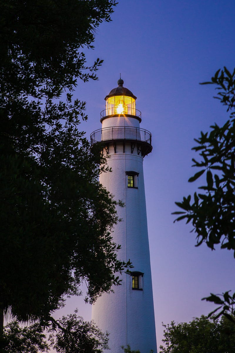
St. Simons Island Lighthouse
610 Beachview Dr, St. Simons Island, Georgia
saintsimonslighthouse.org
Georgia’s second-largest barrier island spans about 12 miles long and 3 miles wide in Glynn County, east of Brunswick. Inhabited since the Late Archaic Period, it later hosted Guale Indian villages and Spanish missions during the 1600s. In 1736, James Oglethorpe built Fort Frederica, site of the pivotal 1742 Battle of Bloody Marsh against Spanish forces. The current lighthouse, built in 1872, replaced the 1810 original, which was destroyed by Confederates during the Civil War to prevent Union forces from being able to use it.
After the Revolution, the island became a prosperous cotton plantation region reliant on enslaved labor. During the Civil War, it was occupied by Union troops. After the war, lumber mills and tourism emerged, boosted by the 1924 causeway. Today, with nearly 15,000 residents, the island blends historic sites like Christ Church and the lighthouse with resort development and natural beauty.
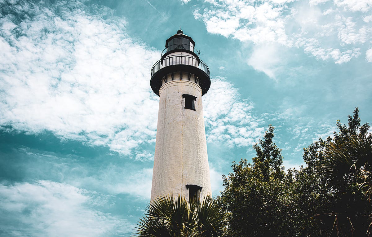
Amelia Island Lighthouse
215 O’Hagan Lane, Amelia Island, Florida
fbfl.us/1097/Amelia-Island-Lighthouse
Amelia Island Lighthouse, located in Fernandina Beach, Florida, is the Sunshine State’s oldest existing lighthouse. Originally built in 1820 on nearby Cumberland Island, Georgia, the brick tower was dismantled and relocated to Amelia Island in 1838 to better guide ships into the St. Mary’s River and Fernandina Harbor. Standing around 64 feet tall with a distinctive white exterior, it was first lit when Florida was still a territory.
The lighthouse survived the Civil War and continues to be an active navigation aid. Owned by the City of Fernandina Beach since 2001, the grounds are open to the public on Saturdays, with interior tours available by appointment.
AND BACK, Day 3:
Amelia Island, Florida > Ratliff, Florida > Midway, Georgia > Charleston, South Carolina
Backroad Route:
6 hours, 30 minutes; 310 miles
Fastest Route:
5 hours, 2 minutes; 285 miles
STARTING POINT
For the final day of this coastal excursion, start at the Amelia Island Lighthouse or Fernandina Beach accommodation of your choice, then head to Thomas Creek Battlefield. Next, stop at Fort Morris State Historic Site in Midway, Georgia, and end your journey at Dills Bluff in Charleston, South Carolina.


Thomas Creek Battlefield
Nassau Village, Ratliff, Florida
battlefields.org/visit/battlefields/thomas-creek
On your way back to Folly Beach, make a stop at the site of the Battle of Thomas Creek, also referred to as the Thomas Creek Massacre. This ambush of Georgia militia by British, Loyalist, and Native American forces occurred during a failed American invasion of East Florida on May 17, 1777, near the mouth of Thomas Creek, south of Callahan in Nassau County. This battlefield is often called the southernmost battle of the Revolution. Visitors will find historical markers, interpretive trails, and preserves that offer a deeper explanation of the battle.
Fort Morris State Historic Site
2559 Fort Morris Road, Midway, Georgia
gastateparks.org/fortmorris
From the Thomas Creek Battlefield, head to Fort Morris State Historic Site, located near Midway, Georgia, where you’ll find some of the state’s most significant Revolutionary War earthworks. Built in 1776 to protect the thriving port of Sunbury on the Medway River, the fort was garrisoned by Patriot forces. In November 1778, Colonel John McIntosh famously defied a British surrender demand with the bold reply, “Come and take it!” The British withdrew but returned in January 1779, capturing the fort after a heavy bombardment.
Under the name Fort Defiance, the bulwark saw service again during the War of 1812. Today, visitors can explore its well-preserved earthen fortifications, enjoy panoramic views of Saint Catherines Sound, and learn about colonial Sunbury through the site’s museum and interpretive film. The 66-acre park also offers excellent birdwatching opportunities.
Dills Bluff
Dills Bluff Road & Fort Sumter Drive, Charleston, South Carolina
battlefields.org/learn/revolutionary-war/battles/dills-bluff
For your last stop, a historical marker on North Shore Drive commemorates the site of the Dills Bluff skirmish in South Carolina. During the final weeks before the British evacuation of Charleston on November 14, 1782, Polish engineer Colonel Tadeusz Kościuszko led a 70-man American force in a daring ambush against British woodcutters at Dills Bluff on James Island. Captain William Wilmot and Lieutenant John Markland’s Continentals surprised the foraging party, but the British quickly reinforced with over 300 troops and artillery.
Outnumbered five to one, the fierce skirmish resulted in ten American casualties, including Wilmot—often cited as the last Continental soldier killed in the Carolinas. Kościuszko narrowly escaped. Though a small engagement, Dills Bluff marked the final combat action of the Continental Army in South Carolina.
